Wild and wonderful, West Virginia has beautiful scenery and great outdoor experiences to offer. For some of the best hiking in the state, look no further than Monongahela National Forest. The huge expanse serves as a great weekend getaway for anyone wanting to unplug from technology and reconnect with nature.
North Fork Mountain Trail to Chimney Top
Distance: 5.3 miles; Elevation Gain: 1,971 feet; Difficulty: Moderate
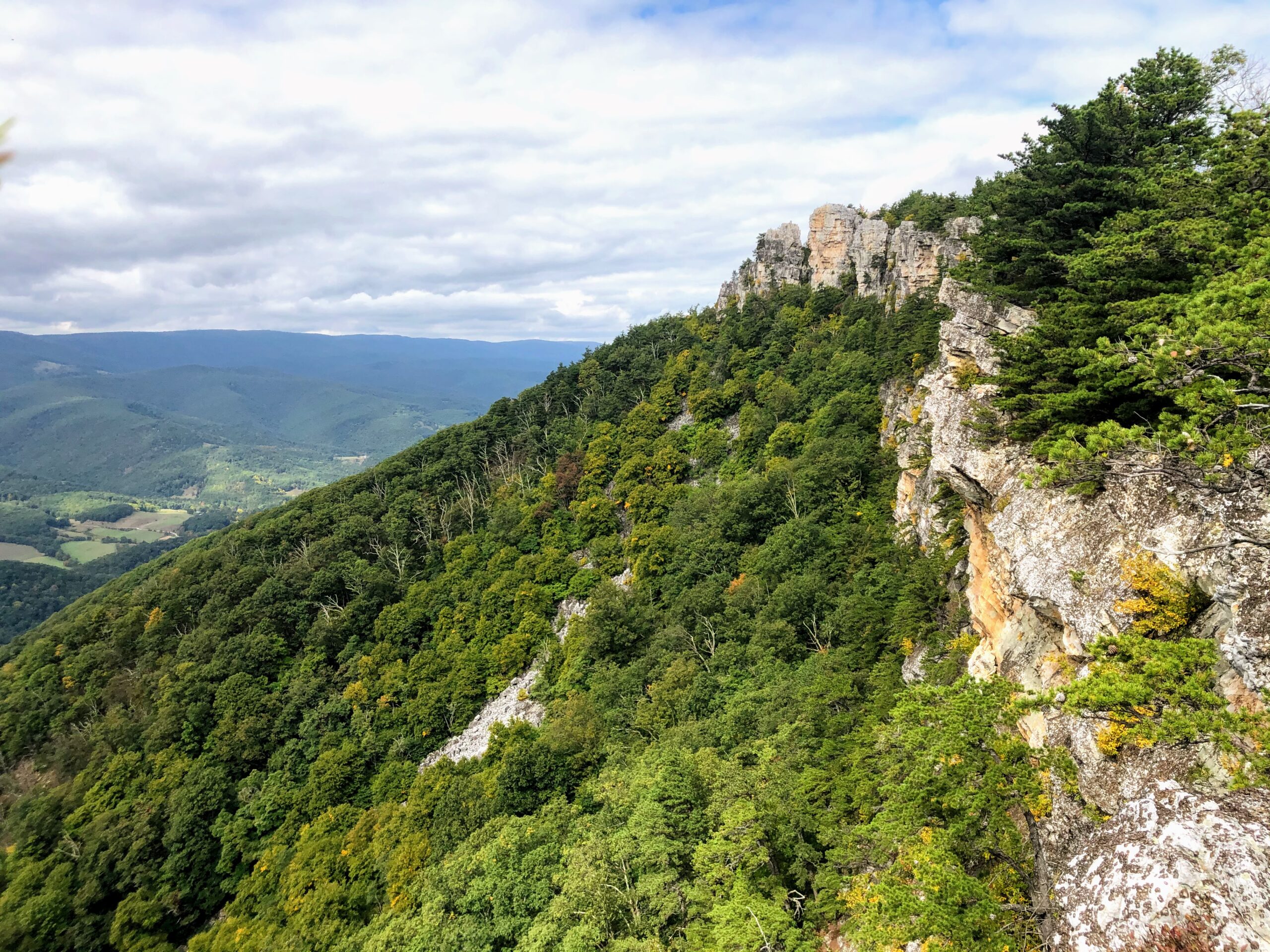
This steep out-and-back trail in the northeastern part of the national forest offers some amazing views of the surrounding ridge-line and foliage. The consistent incline throughout the hike can get pretty tiring if you’re not in great shape, but the summit makes it all worth it.
We chose to do this hike as a less-crowded alternative to Dolly Sods. It definitely fit the bill, but we still ran into a decent number of people on the trail since we went on a Saturday morning. Honestly, the most crowded part of the experience was the parking. There’s no designated lot, so you’ll have to find a spot along the road by the trailhead. Expect to walk just a few minutes from your car.
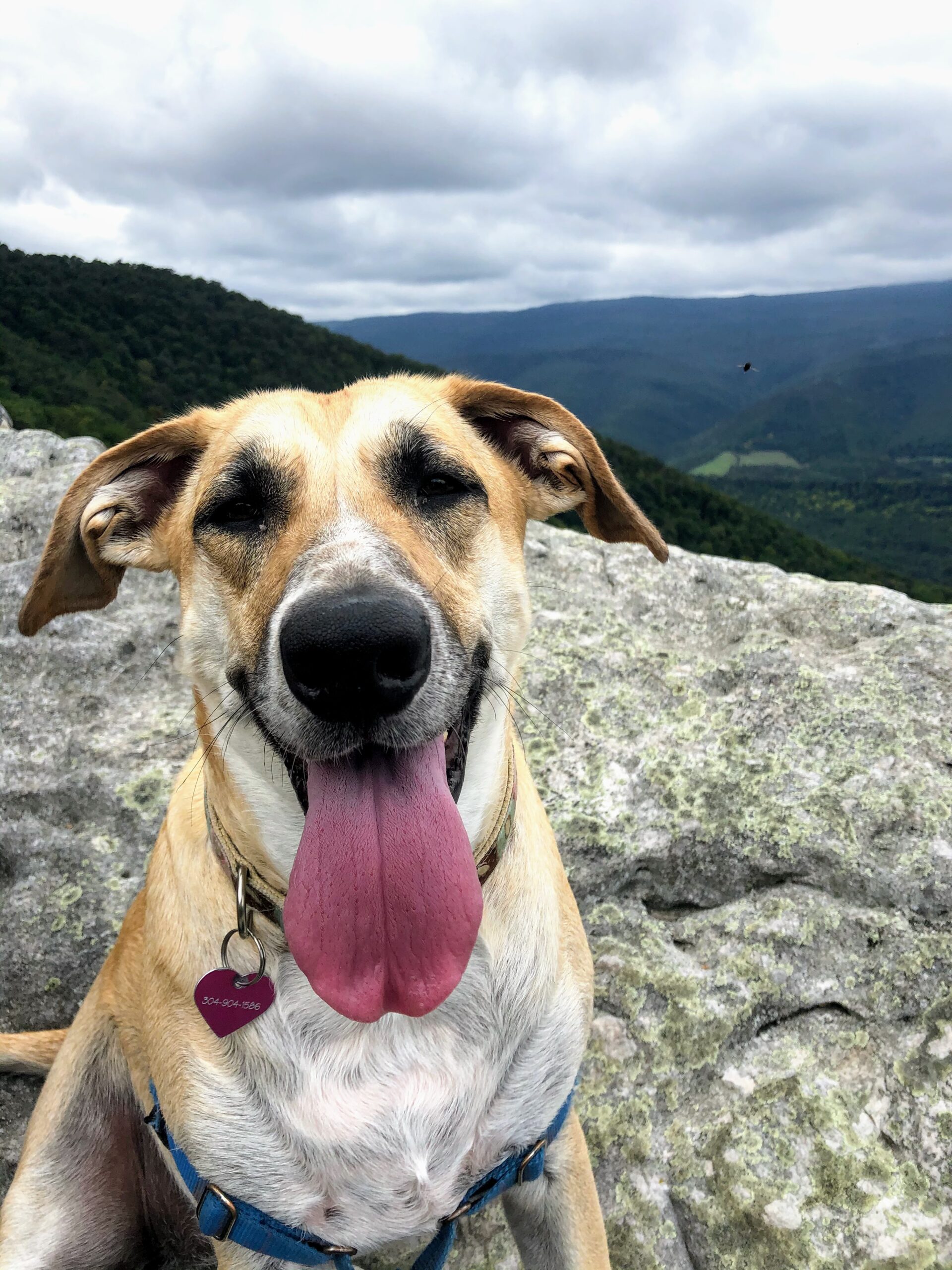
Once you make it on to the trailhead, you start climbing almost immediately. The trail floor is a bit rocky towards the beginning, so you may want to consider giving your furry friend some boots. We unfortunately didn’t listen to this advice. Arya was not happy with us towards the end of the hike.
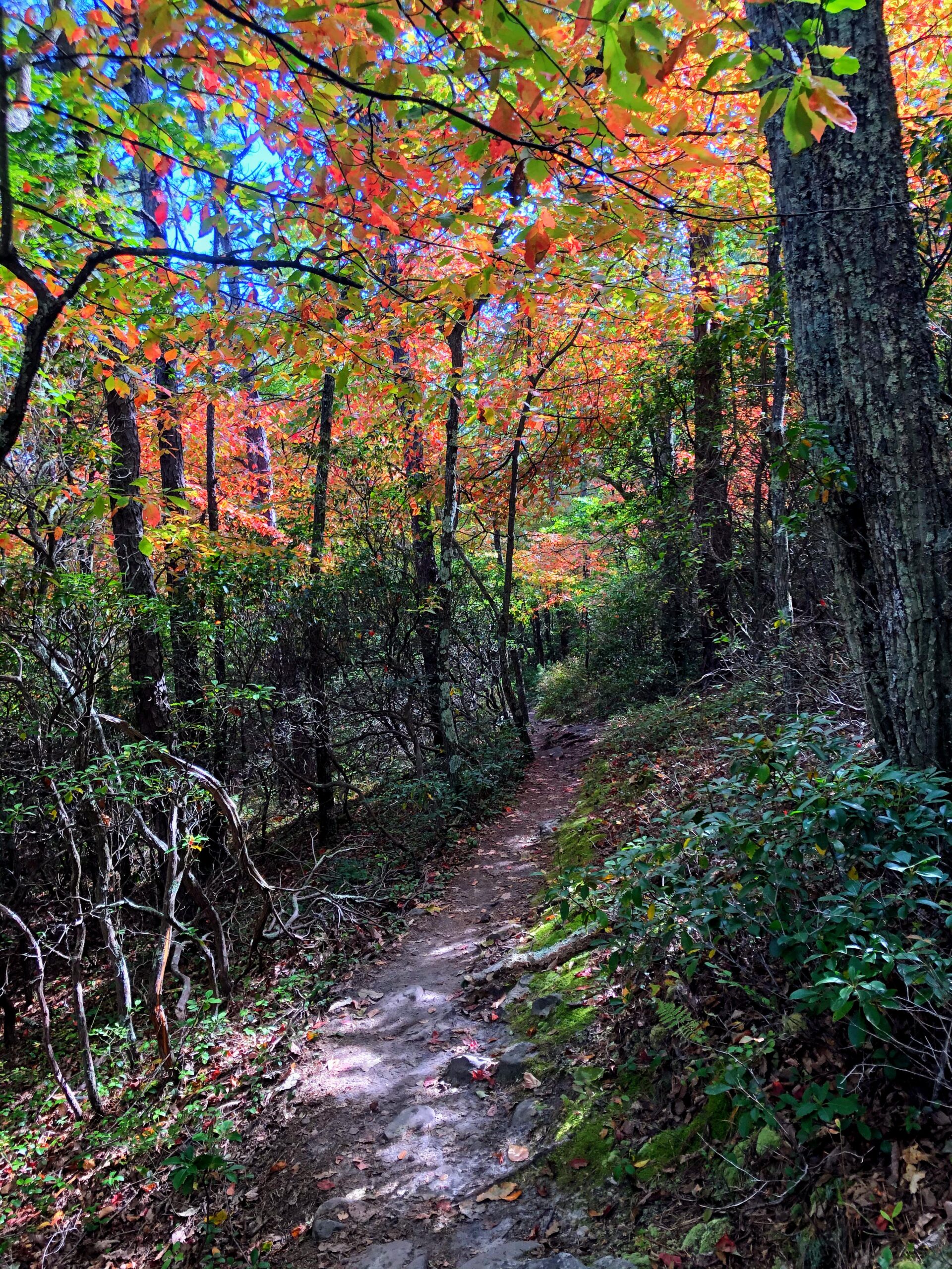
As you ascend, though, you’ll be surrounded by tall trees lining your path and providing shade for a warmer day. If you visit in the fall, the trail can feel almost magical, as the light will shine through red, orange, and yellow leaves hanging overhead. The foliage was just starting to change when we visited towards the end of September, so we can only imagine how pretty it would be in early-to-mid October.
After about 2.5 miles, you’ll reach a fork in the trail. To the right will be a steep climb along an unmarked, relatively overgrown path. Straight ahead will be a continuation of the trail, with the same blue markers you’ve been following to this point. Somehow going straight was NOT the right answer. Whoops. We ended up going an extra half mile or so along the straight path before realizing we had missed the summit. In hindsight, though, this wasn’t a bad decision. There are some really nice overlooks along this part of the trail. Going this way also gives you the option of turning the trail into a loop that spits you out a bit further down the road where you parked.
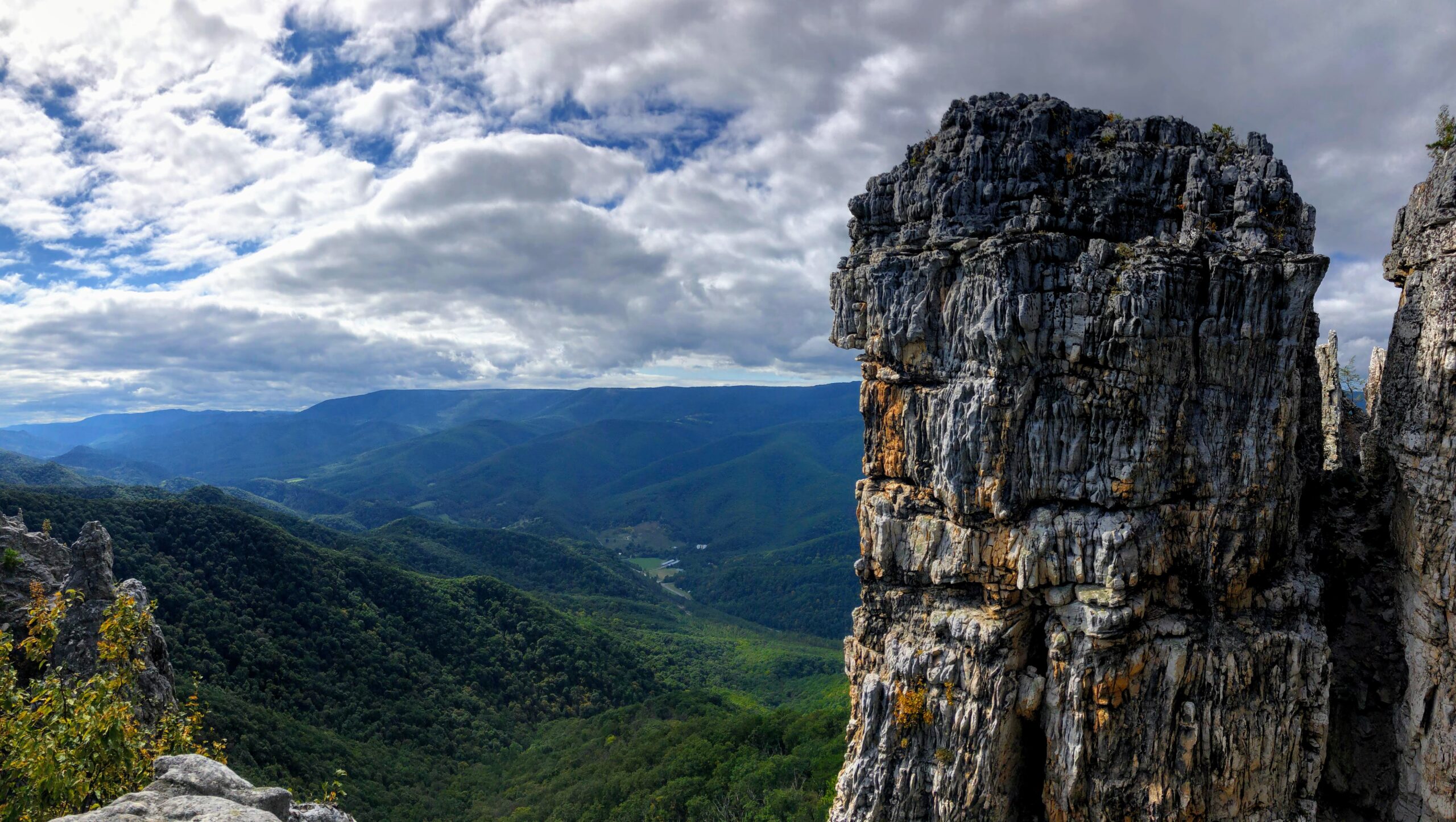
After doubling back and climbing the very steep path to the summit, we realized what we would have missed. The views are spectacular. The trail spits you out right at the chimney top, so you have an opportunity to climb some boulders and explore the different perspectives. Take a moment to relax up here, have some snacks, and enjoy the crisp mountain air.
The way back down isn’t too bad at all and may take as little as half the time it took you to make the ascent. Note that there are no toilets or facilities of any kind at this trail, so make sure to pack enough water and leave no waste behind.
Seneca Rocks Trail
Distance: 2.7 miles; Elevation Gain: 836 feet; Difficulty: Easy

A bit further south into the national forest lies Seneca Rocks State Park. While on the smaller side, this state park has some great views to offer. In our opinion, the best way to experience those views is from the top of the Seneca Rocks Trail.
While AllTrails considers this trail a loop, we chose to do it as an out-and-back instead. The trail going clockwise was just so well maintained that we saw no reason to do the steeper descent on the back end of the loop. Overall, the hike wasn’t too strenuous at all. The views at the top are well worth the modest incline.
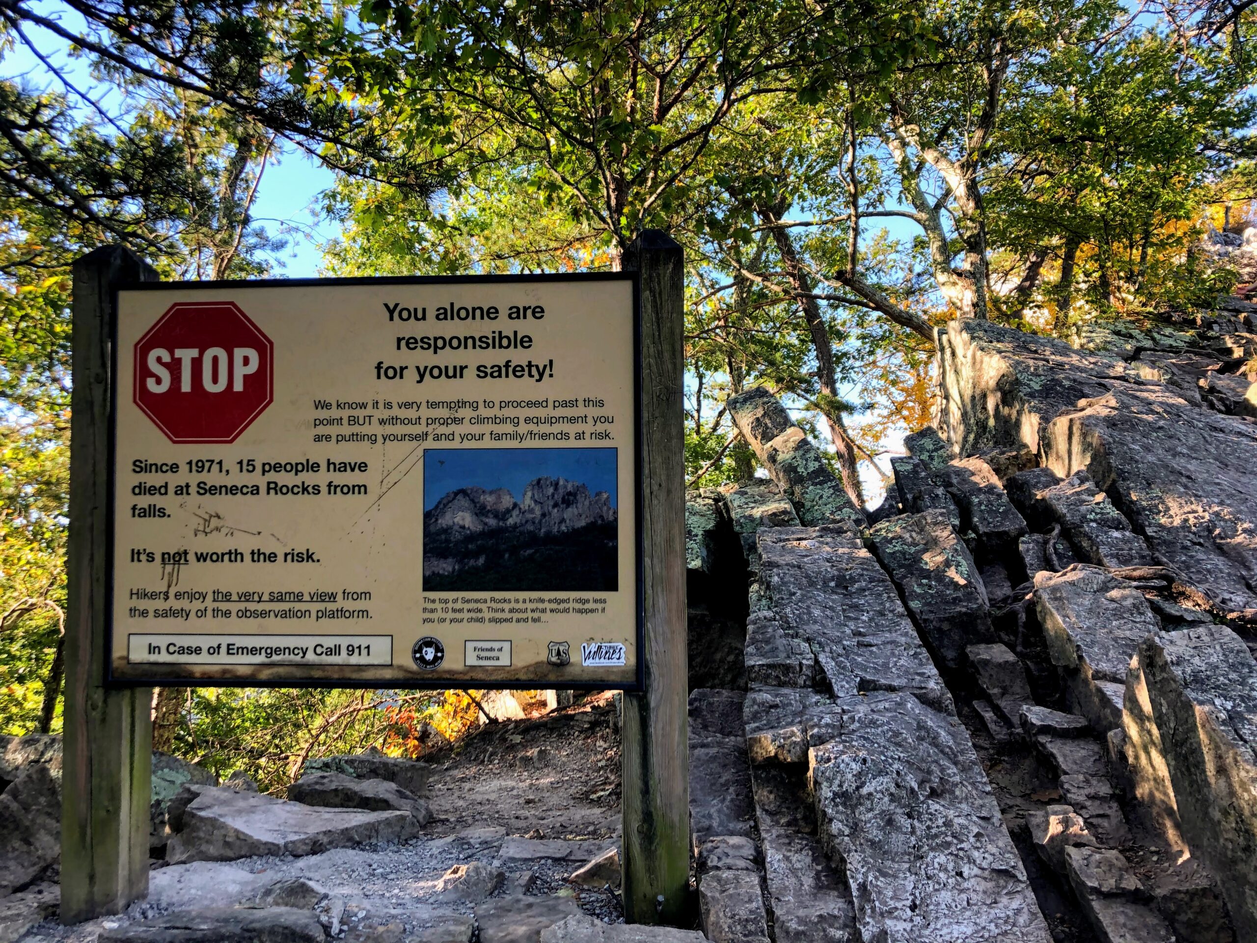
Once you make it to the summit, you’ll notice a couple “Danger” signs warning you to not go any further. Please be careful here. Quite a few people have died by going off trail at the top, so this is no joke. That being said – there is an opportunity to go a bit past the sign to a knife ridge scramble along the rocks. The view there isn’t really that much better than the one you get from the large observation deck before the sign, but the scramble itself can be fun. Just put safety above all else.
Getting to this hike is also a breeze. The trailhead has a huge parking lot, toilets, and an observation deck along the creek that lets you look up at the rocks. We did the hike around 8:00am on a Sunday and ran into almost no people, so we’d definitely recommend getting here early. From what we read, the hike can fill up later in the day and make for a less pleasant experience.
Bear Rocks Preserve
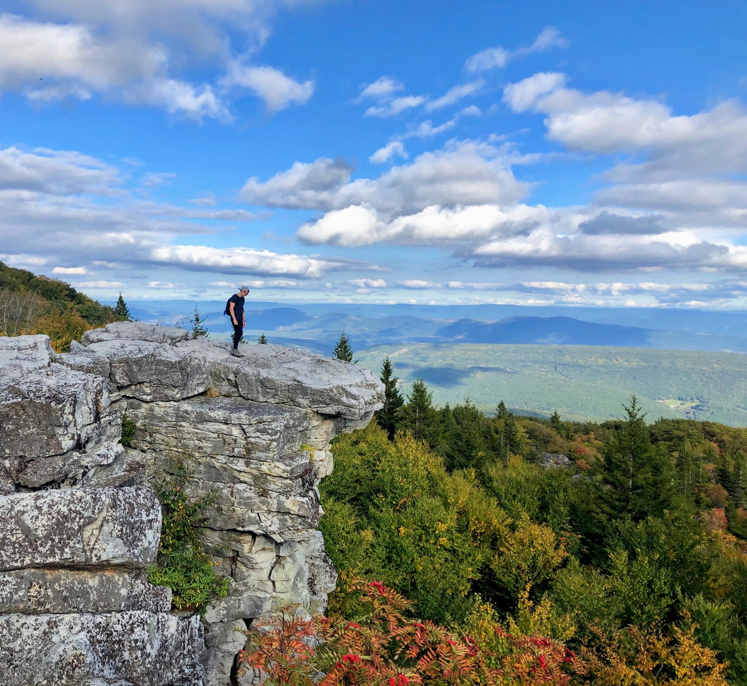
This area is stunning. We had heard a lot about the beauty of the Dolly Sods Wilderness, but it’s hard to know what to expect until you get there.
Getting to Bear Rocks Preserve is quite an experience in itself. Shortly after you turn on to Forest Road 75, the road narrows and becomes graded. In addition, it is covered in dust – so much so that the cars driving in front of you kick everything up and really make it hard to see. You’ll have to crawl along this shrouded road for a few miles before everything opens up and becomes more clear as you approach the preserve.
Once you make it close to the preserve, you better start looking for a parking spot. It gets really crowded. We arrived around 4:45pm on a Saturday and saw almost no spots available along the road. Your best bet is to pull over and walk a bit once you find an option.
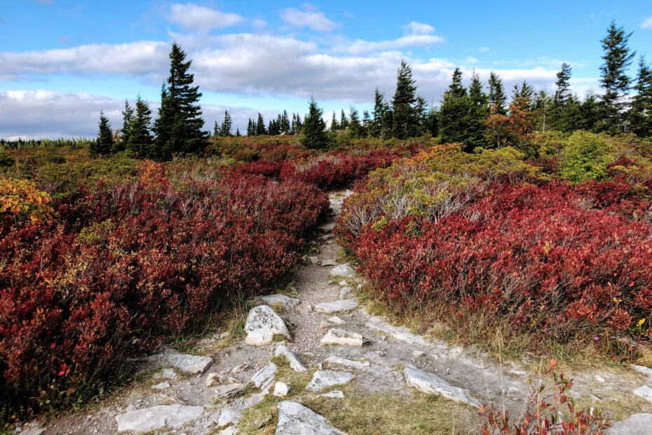
While there are a lot of trails through Dolly Sods that start just south of Bear Rocks Preserve, we chose to instead go off trail and explore the preserve itself. We were really happy with this decision, as the biodiversity in the area is awesome. You can also get some incredible views by heading towards the ridge line and stepping out on to the large rocks.
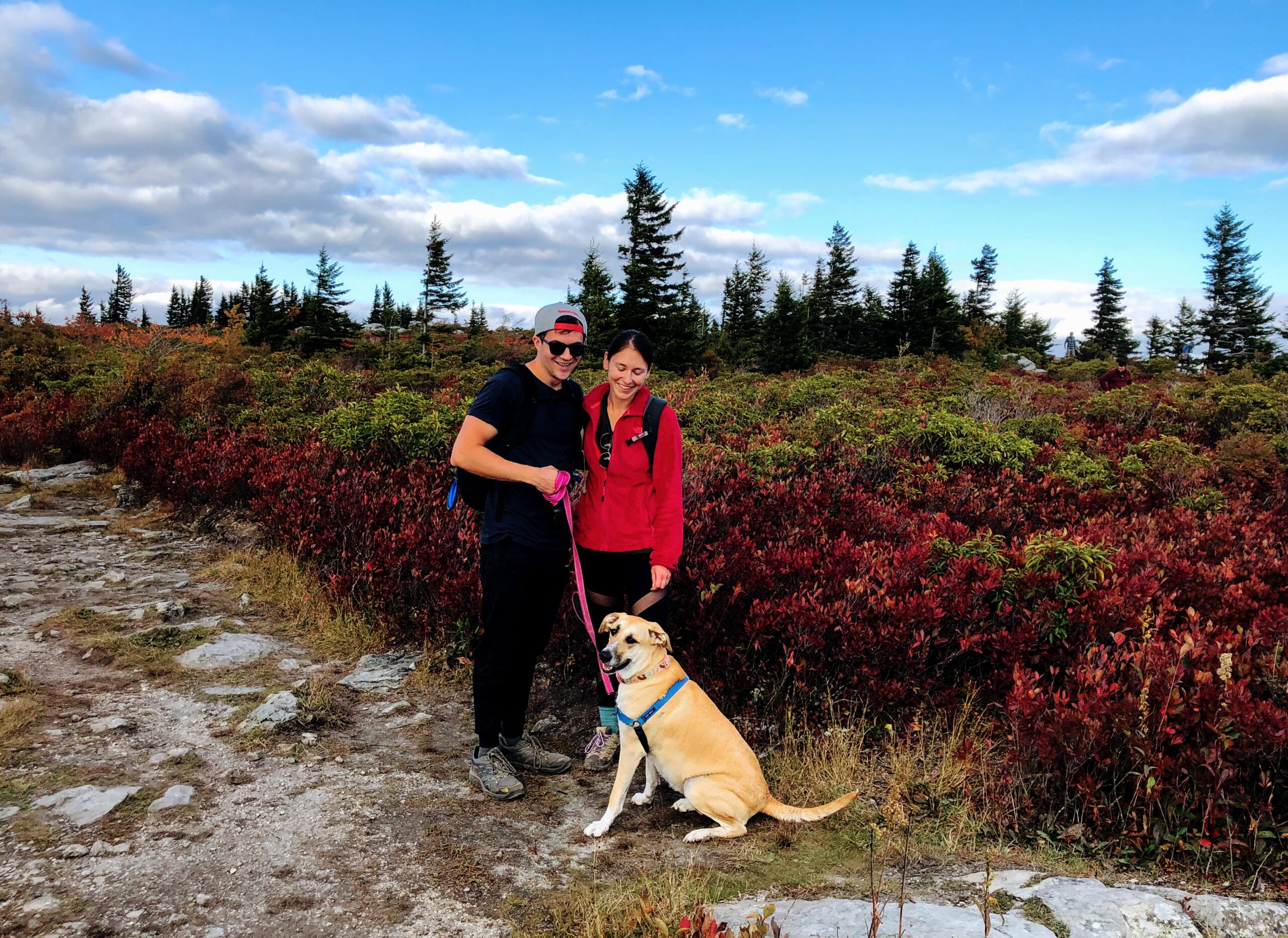
When we visited towards the end of September, the foliage was spectacular. There’s a reason families around West Virginia travel here for fall photos. While a lot of the trees in the valley hadn’t yet changed, the shrubs and other plants around the preserve had already started to become a rich combination of reds and yellows. You’ll love it.
One other thing to note – Google says that the preserve closes at 5:00pm on Saturdays, but this wasn’t true when we were there. In fact, we don’t even see how this area can be closed since it’s wide open with no facilities. You’re probably fine getting there after the stated closing time if that’s what your schedule requires.
Other Tips & Tricks
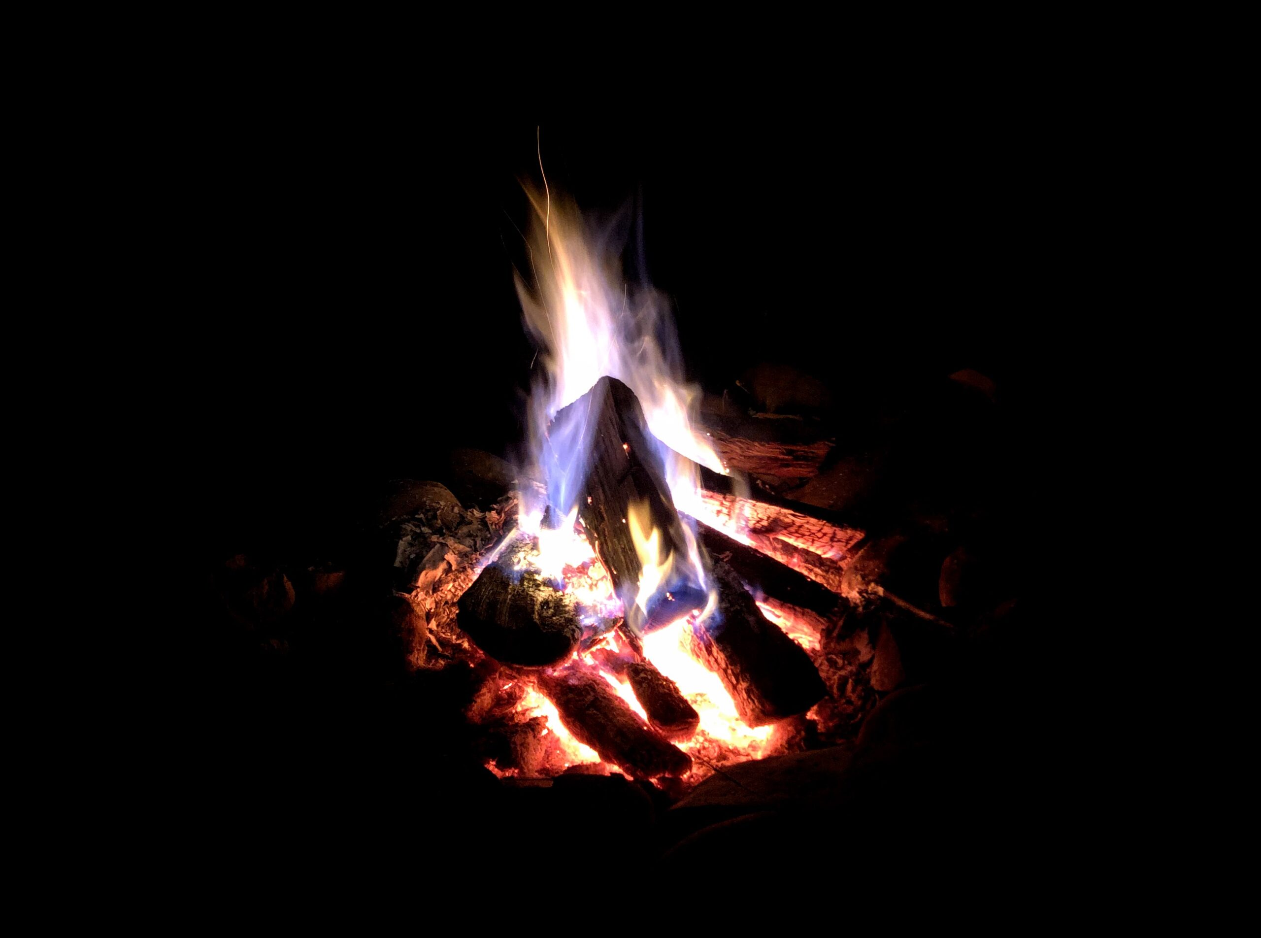
- Where to Stay: Camping is definitely the best option for the Monongahela National Forest. The crisp air and clear skies make for perfect star gazing conditions around a campfire. If you want to stay in the Dolly Sods area, Red Creek Campground is the only established campsite, but backcountry camping is really common here. Just be warned that Red Creek Campground is very small, is first come first serve, and fills up pretty much every single weekend. Since we didn’t feel like backcountry camping, we instead decided to stay in Seneca Rocks State Park. While the state park has its own campground (Seneca Shadows), we opted to stay at Yokum’s Vacationland. This campground is also first come first serve, but it always has plenty of space available. It also has a very convenient general store in case you need to pick up any essentials during your trip.
- Cellphone Service: Expect to be without service during your visit to Monongahela. If you’re camping, chances are you also won’t have WiFi. We recommend downloading an offline map ahead of time to help you get from hike to hike.
Happy traveling!
Kitrina & Jordan